
3D Scanning Services
PEAK Architecture LLC
At PEAK Architecture, we utilize a LiDAR-based precision laser scanner to document existing buildings, sites, and their respective surrounding elements. The scanner can accurately measure 2 mm in detail with a scanning range of 262 feet per scan.
We have the ability to take multiple scans, link them together, and create a comprehensive scan of the project. Once we have the data, we can perform multiple functions such as capturing all existing building/site conditions, fill/volume calculations, and analysis for beam/floor deflection. When used in conjunction with a DWG survey, we can create a digital composite with a legal site registered to an accurate reconstruction of the physical building. We’re able to export in a variety of formats, allowing our clients to import the created as-built documents or the point cloud data itself.
The Benefits of Our 3D Scanning Services
The benefit of scanning a project is having an as-built drawing set that is highly accurate, saves time, and once a project is thoroughly scanned, no further site visits are required. Most medium-sized projects can be scanned within a four to six-hour window with a single operator on site. A very large residence may take between one to two days with a single operator. The scans can be cleaned, and a point cloud exported within three hours. The point cloud can then be imported into a drafting program and underlaid as an X-reference and traced over for the as-built documents.
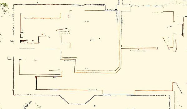
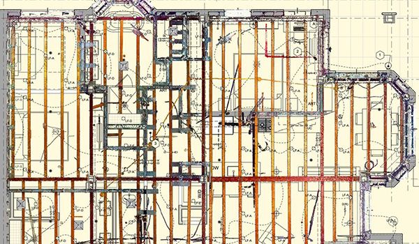
Floor Plans
Above is a thin slice from the point cloud data of a scanned project. Full point cloud data allows the model to be sliced at any desired height, allowing us to capture finished interior walls, door and window locations, as well as sill, head, and casing details. Illegible field measurements, skewed walls, or unexpected field conditions are no longer problematic for getting a clean file. Scans like this are helpful in seeing construction quality as sub-standard framing or concrete formwork becomes very noticeable very quickly.
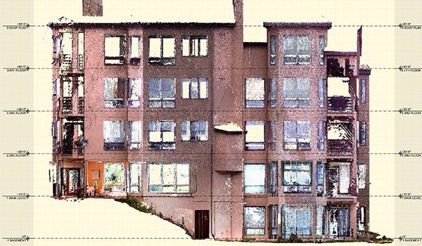
Elevations
Full point cloud data allows for an accurate orthographic capture of building elevations including hard-to-reach eaves and ridges. Survey datum points may be required depending on project location, but scanned data allows great initial data without having to risk life and limb to measure high and hard-to-reach places.
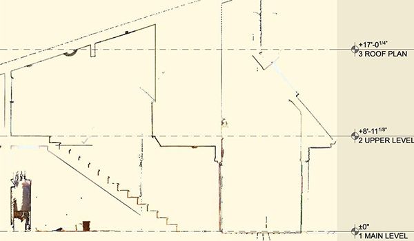
Sections
Full point cloud data allows the model to be sliced at any given point through the building and allows for easy As-Built creation as well as inspection of existing conditions. The first image is a lateral scan before any linework has been generated.
This second image demonstrates how the scanner documented a six-inch settling of the building. Variation from point cloud data between models is highlighted in red. The house bisected two different soil types in a 500-year floodplain.
Reflected Ceiling Plans
Reflected Ceiling Plans: This under-construction project was able to have all existing joists, sprinkler runs, as well as plumbing and electrical drops captured. From that point cloud scan, new RCPs were able to accurately be created while avoiding all new construction above, giving direction to the architect while avoiding in-field interpretation that possibly deviated from the design.
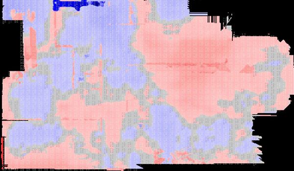
Floor Flatness/Beam Deflection
An analysis can be provided to help see high and low spots within existing floor surfaces (red are high spots and blue are low spots). A flatness analysis can also be performed on a beam to see if there is any deflection or if any structural component is compromised.
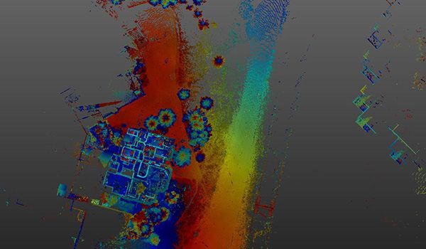
Site & Surrounding Elements
A comprehensive point cloud can provide context between the primary structure and adjacent structures, such as the gondola/tower shown center right, as well as the adjacent condominiums on the far right. The scanner’s ability to precisely scan up to 262 feet in a single scan can capture all this information in a single point cloud file.
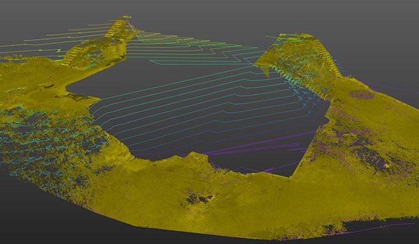
Site Isolation & Topography
Site topography can be utilized to find exact heights of grade at the building exterior to help determine FAR calculations. Contours may be generated for schematic purposes but are not legally binding.
Work With Peak Architecture Today
If you’re interested in learning more about our 3D scanning services, reach out to the team at PEAK Architecture in Basalt, Colorado today.